
Surveying Services
Estimates by Appointment | Cost-Effective Services | Licensed in California
FREE EstimatesCost-Effective ServicesLicensed in California
Para Español
Areas of Specialization
Full Service Surveying and Consulting
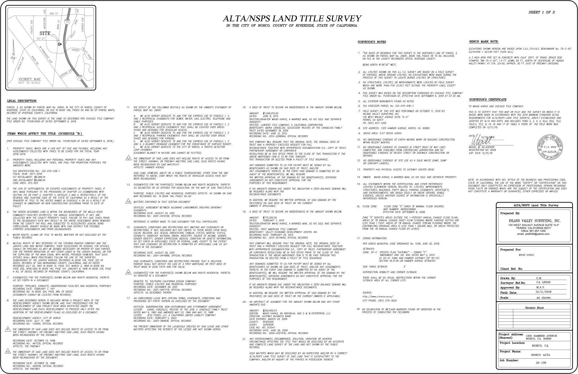
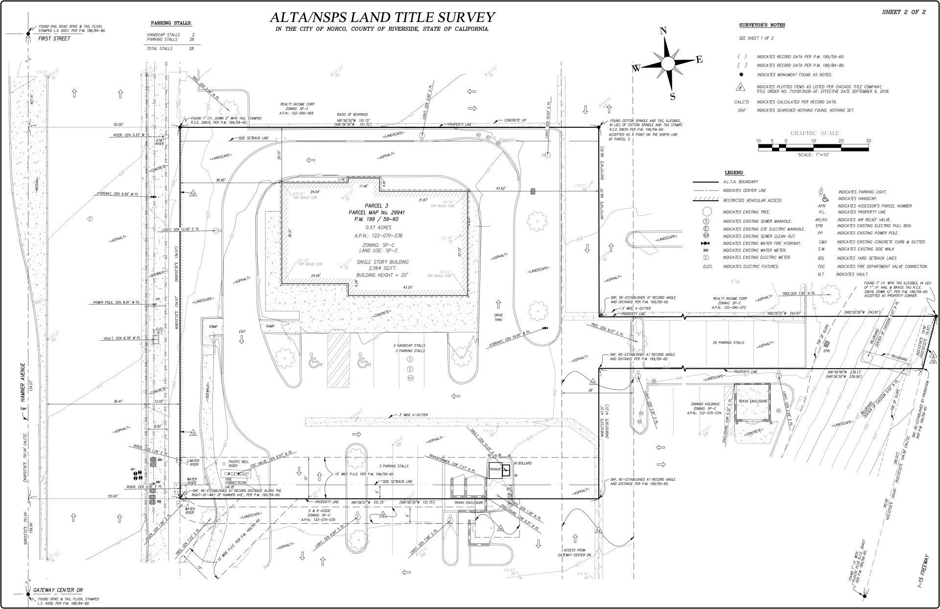
ALTA/ACSM Land Title Surveys:
An ALTA/ACSM is a detailed survey, prepared in accordance with standards specified by the American Land Title Association and the American Congress of Surveying and Mapping.Shows the property boundaries, property improvements location including but not limited to all/any structures, fencing, roads and utility lines along with the location of all/any easements.An ALTA survey is primarily required for commercial properties or loans over one million dollars.
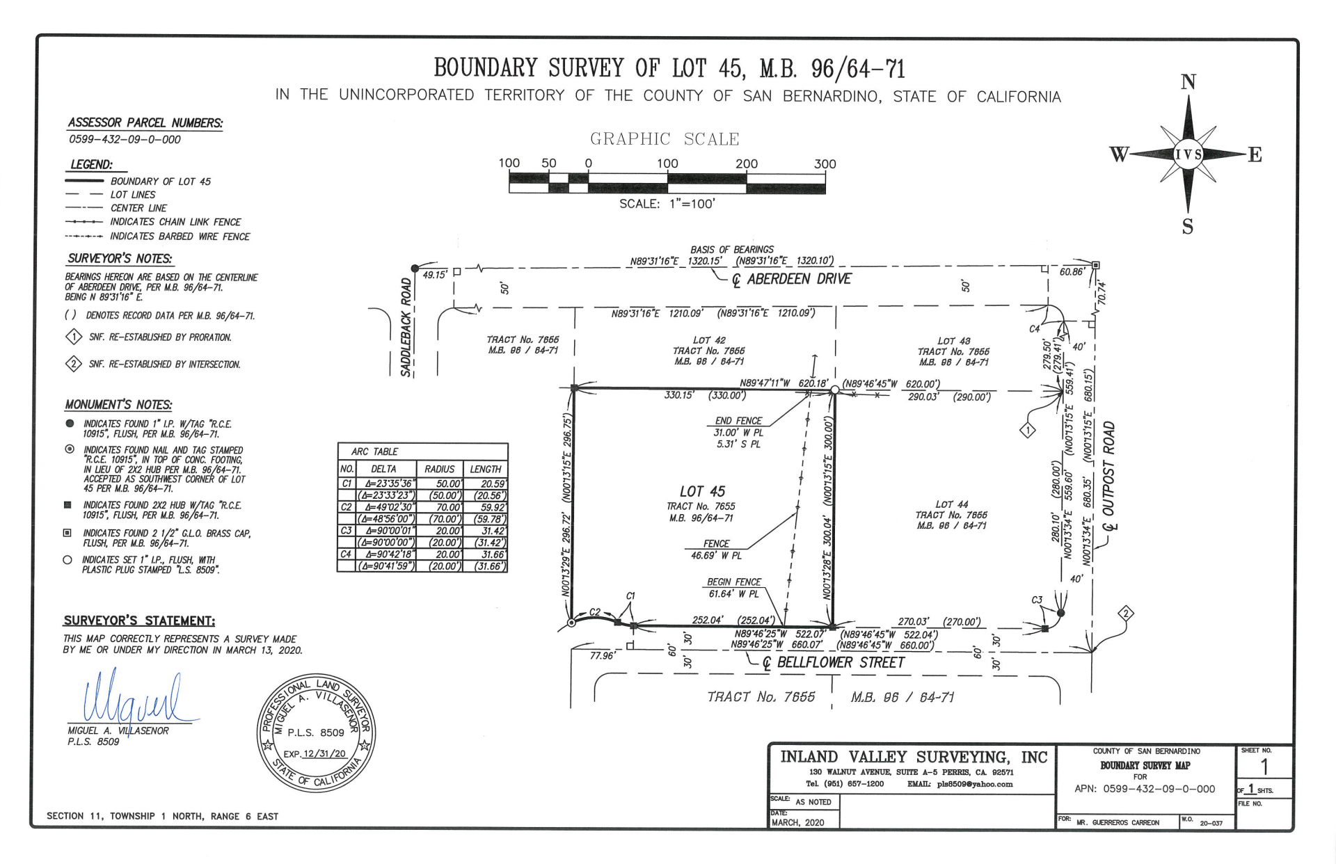
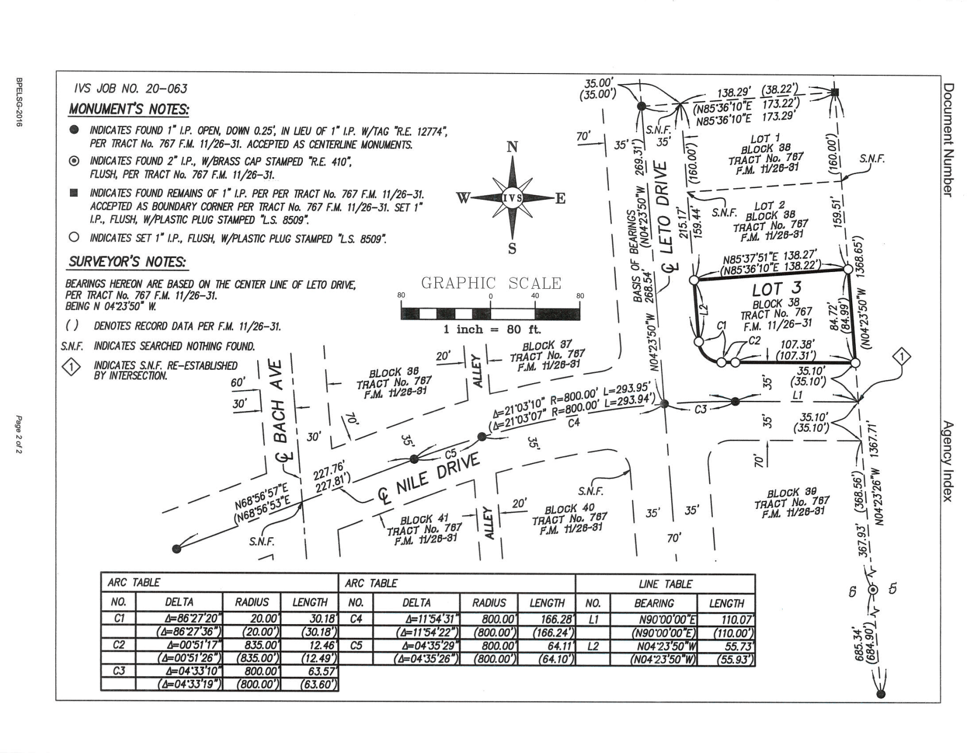
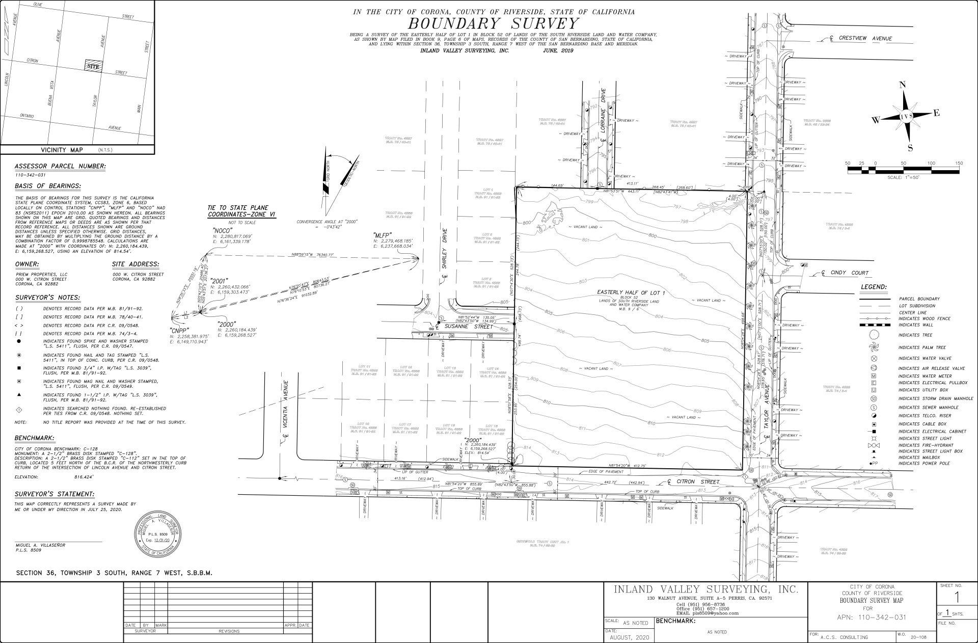
Boundary Surveys:
A boundary survey is a process carried out to determine property lines and define true property corners of a parcel of land described in a deed or shown on a recorded map.
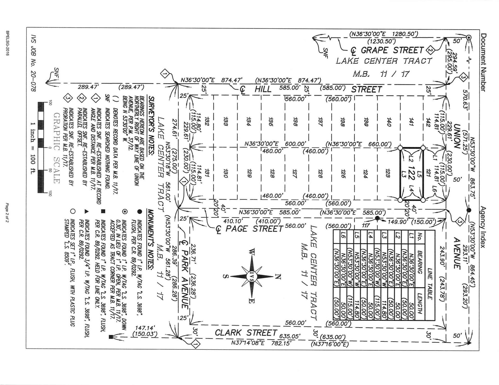
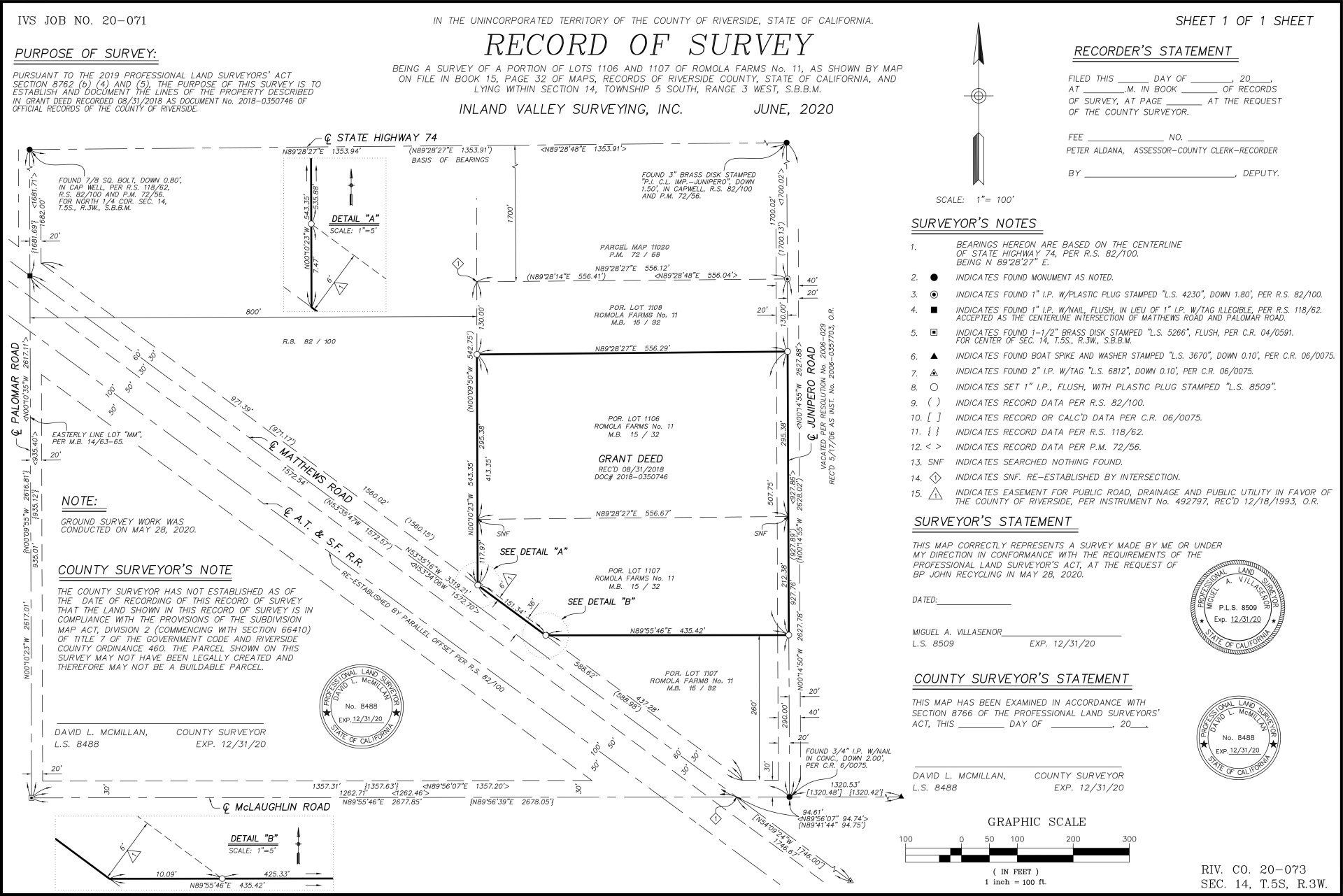
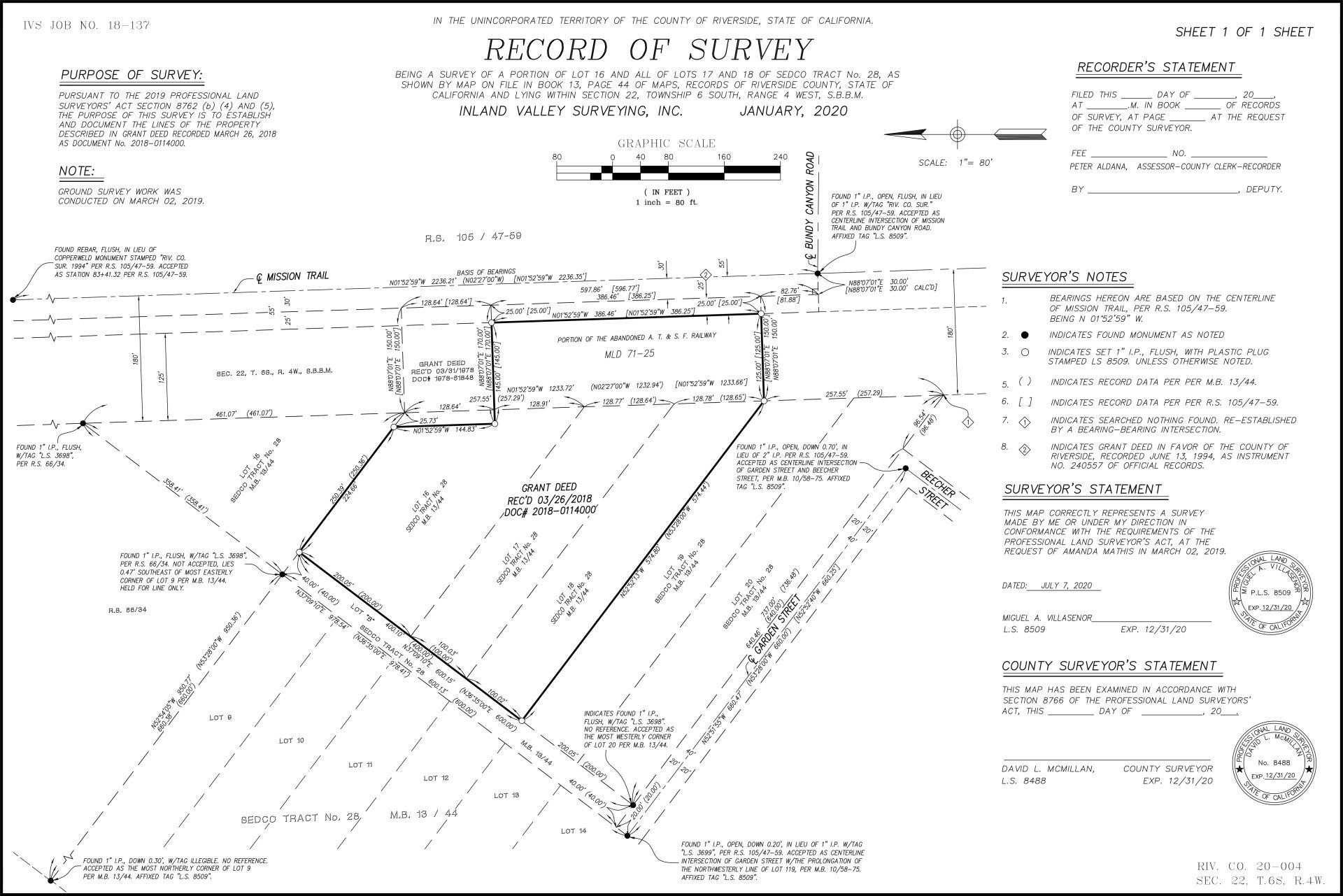
Record of Survey:
A Record of Survey is an official map that is reviewed by the County Surveyor's’ Office and then recorded with the County Recorder’s Office.
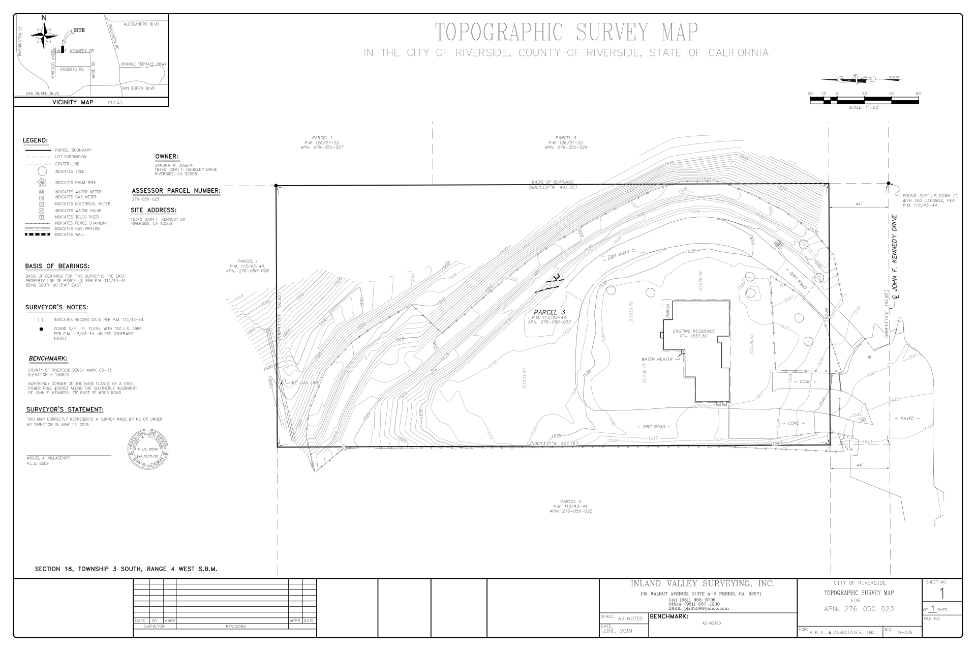
Topographic Mapping for Architectural and Engineering Design:
Topographic Mapping Surveys are used to identify and map the contours of the ground and existing features on the surface of the earth or slightly above or below its surface.Topographic maps are done for small residential lots as well as for multi-acre properties.
Construction Surveying and Layout:
Construction surveying is to stake out reference points and markers that will guide the construction of new structures such as roads or buildings. These markers are usually staked out according to a suitable coordinate system selected for the project.
FEMA Elevation Certificates:
FEMA elevation certificate is information needed to show compliance with the floodplain management ordinance and also useful by property owner to obtain flood insurance.
Easements and Legal Descriptions:
An easement is a right to cross or otherwise use someone else’s land for a specified purpose without having ownership rights.
Land Divisions:
Also known as "subdivision", the division of a lot, tract, or parcel of land into two or more lots, plats, sites, or other divisions of land.


Additional Services
Fee for Estimates may apply.
Planning & Development
- Deed and Map Research
- Parcel Mergers
- Parcel Maps
- Subdivision Maps
- Tract Maps
Construction Services
- Staking Layout
- Surveys
Schedule Your

Share On: